Products › Screeny — parcel images
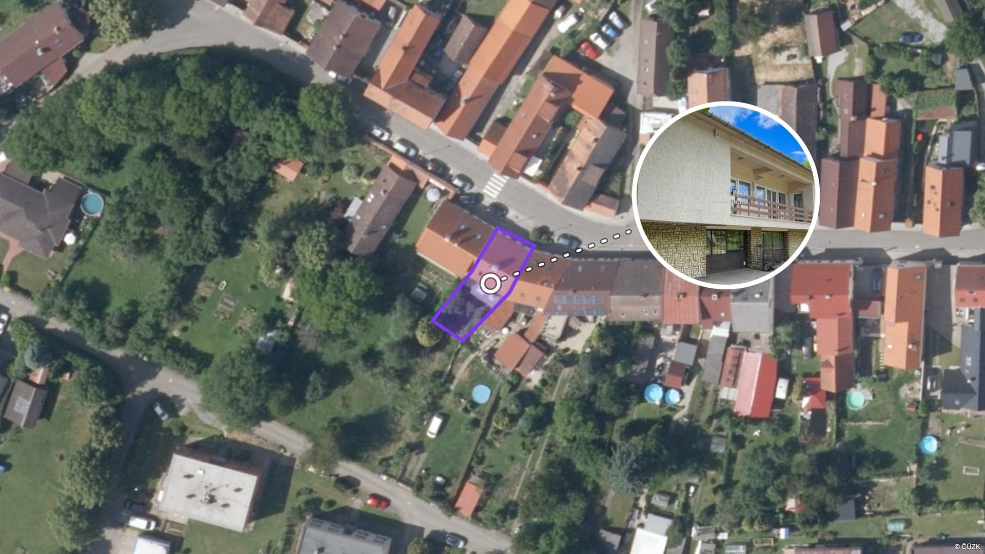
Screeny: satellite image with the parcel outlined
Screeny is the Elidat tool that turns a title deed or parcel numbers into a satellite image of the property with the plot boundaries precisely outlined according to the cadastre. From one image a buyer understands where the parcel lies, its shape, what borders it and what the surroundings look like — no drone and no drawing on a map by hand.
At a glance
- Input
- title deed (PDF) or parcel numbers + cadastral area; Czechia, Slovakia, Poland
- Output
- PNG at three zoom levels: parcel detail, town, region; labels with area and parcel numbers
- Time
- under 1 minute
- Price
- download 1 AI use (25 credits) per zoom level; preview free
What Screeny does
- Boundaries from the cadastre — parcels are drawn exactly from cadastral data (Czechia, Slovakia, Poland), including several at once — as a merged outline of the whole plot or each parcel separately.
- Three zoom levels — parcel detail for shape and neighbours, town view for the position within the built-up area, region for access and wider context.
- Labels — area in m², parcel numbers, property name; move and edit labels in the editor.
- From a title deed — upload the PDF and Screeny reads the parcels itself; nothing to retype.
- Agency style — outline colour and logo per your agency (Office plan).
How it works
- Open Screeny and upload the title deed, or enter the cadastral area and parcel numbers.
- The app finds the parcels and draws them on the satellite image; the preview is instant.
- Adjust labels and pick a zoom level.
- Download the PNG; each zoom level is charged once, further downloads of the same level are free.
Where to use Screeny
- Land sales — the listing's cover image, showing the shape and position of the parcel better than a photo from ground level.
- Family houses and cottages — garden size and plot boundaries that are not obvious from photos.
- Development projects and farmland — several parcels in one image with a merged outline.
- Video tour — the same data powers the satellite flyover in the video; Screeny is its static version for the listing.
Price
Previews are free. A download costs 1 AI use on a subscription or 25 credits per zoom level. Plans on the pricing page.
Frequently asked questions
Where do the parcel boundaries come from?
From public cadastral data — ČÚZK in Czechia, the cadastral portal in Slovakia and ULDK/EGiB in Poland. Boundaries reflect the register as of the day the image is created.
Can Screeny handle several parcels at once?
Yes. It loads all parcels from the title deed and outlines either the merged plot or each parcel separately.
How recent is the satellite imagery?
We use current satellite basemaps from map providers; imagery age varies by location, typically 1–3 years.
How much does Screeny cost?
Preview free; download 1 AI use (on a subscription) or 25 credits per zoom level. Repeat downloads of the same level are free.
More products
Listing copy
A property description from details and photos — for portals, your website and social media.
AI Copilot
An assistant that builds the video from your uploaded photos and suggests what to improve.
Property video tour
A finished video from photos and an address — satellite flyover, voice-over and music.
Try Elidat for free
Sign up without a credit card. Your first results are ready in minutes.
Try for free